


Rodeneck

VacheKiri67
User
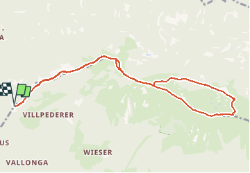

Length
10.8 km

Max alt
1919 m

Uphill gradient
266 m
Km-Effort
14.3 km

Min alt
1732 m

Downhill gradient
265 m
Boucle
Yes
Creation date :
2019-07-31 08:10:47.621
Updated on :
2019-07-31 13:16:30.063
3h47
Difficulty : Easy

FREE GPS app for hiking
 SityTrail
IGN / Geographical institutes
SityTrail Plus
The world is yours!
About
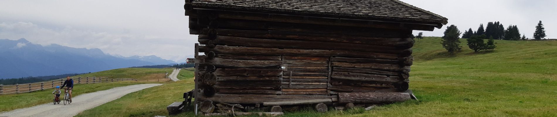
Trail Walking of 10.8 km to be discovered at Trentino-Alto Adige/Südtirol, South Tyrol, Rodeneck - Rodengo. This trail is proposed by VacheKiri67.
Photos


Positioning
Country:
Italy
Region :
Trentino-Alto Adige/Südtirol
Department/Province :
South Tyrol
Municipality :
Rodeneck - Rodengo
Location:
Unknown
Start:(Dec)
Start:(UTM)
708246 ; 5183780 (32T) N.
Comments